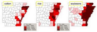
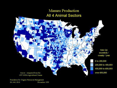
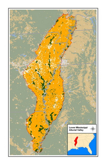
BioEnergy Systems LLC (BES) has performed numerous assessments of biomass resources for various geographic scopes.
|
 |
 |
Biomass Resource Assessments
|
BioEnergy Systems LLC (BES) is a consulting firm and project development company based in Fayetteville, Arkansas.
BES was established in 2005 by Jim Wimberly. |
BES works closely with Winrock on a variety of projects and activities related to clean energy, agricultural and rural economic development, and ecosystems management. Winrock International is a nonprofit organization that works with people in the United States and around the world to empower the disadvantaged, increase economic opportunity, and sustain natural resources. |
BES is a supporter of Environmental and Energy Study Institute (EESI), a nonprofit organization established in 1984 by a bipartisan, bicameral group of members of Congress to provide timely information and develop innovative policy solutions that set us on a cleaner, more secure and sustainable energy path. EESI accomplishes these objectives in three ways:
|
BES is a supporter of 25x’25, which is a rallying cry for renewable energy and a goal for America – to get 25 percent of our energy from renewable resources like wind, solar, and biofuels by the year 2025. 25x'25 is supported financially by the Energy Future Coalition, a non-partisan public policy initiative funded by foundations. |
|
BioEnergy Systems LLC 1726 N Charlee Ave Fayetteville, AR 72703 tel: 479-527-0478 fax: 612-605-5749 |
email: info@biomass2.com
website: www.biomass2.com |